
ATCOR 3: Example Results
Basics | Features | Sensor Support | Methods | ATCOR-2 Results | ATCOR-3 Results
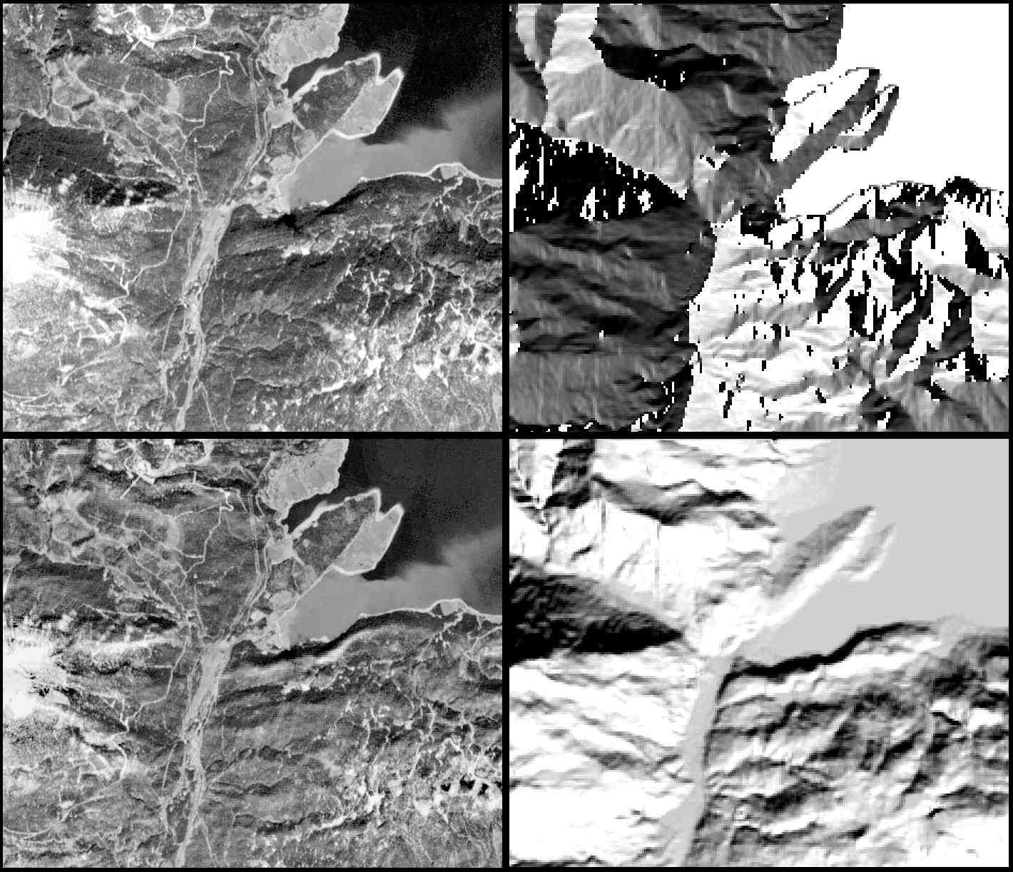
1. SPOT Panchromatic Imagery
The following image shows the result of the combined atmospheric and topographic
correction on SPOT-1 panchromatic imagery. The scene was recorded on 19th April 1988 and contains
part of the Walchensee lake and surrounding mountains in the Bavarian Alps.
The solar geometry is: zenith angle of 38 degree, azimuth angle of 158.3 degree.
The top left image presents the original scene, the bottom left image the corrected scene. The top right section
shows the aspect image (flat areas of the lake are coded bright), the bottom
right section is the illumination image, i.e. the cosine of the local solar zenith angle,
so bright areas indicate a small local solar zenith angle (or high sun), whilst dark
areas receive less or no direct solar radiation.
The ATCOR3 processing compensates for the influence of the atmosphere and topography
on the recorded signal and calculates a surface reflectance map for a flat
horizontal plane.
This example shows that atmospheric/topographic correction is even useful
for panchromatic imagery. Here, emphasis is on the elimination of topographic
effects, not on the surface reflectance retrieval.
 (162k)
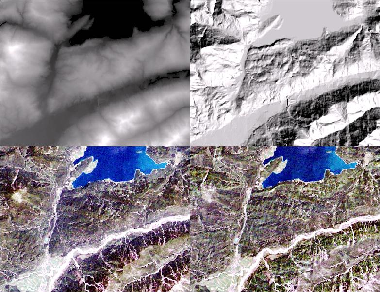
 2. Landsat-5 TM Imagery
A nearby area of the Walchesee lake is shown in the following figure. It shows part of a TM scene acquired on 28th July 1988. The solar zenith angle is 34.6 degree, and the solar azimuth angle is 131.7 degree. The top left of the mosaic is the DEM (800 - 1800 m asl) and the top right image is the illumination image. The bottom left section shows the original TM data (bands 3/2/1 coded RGB), the bottom right section shows the surface reflectance image after combined atmospheric and topographic correction. Areas that appear dark in the original image due to a low solar illumination are increased to the proper reflectance level in the corrected image.
 (137k)
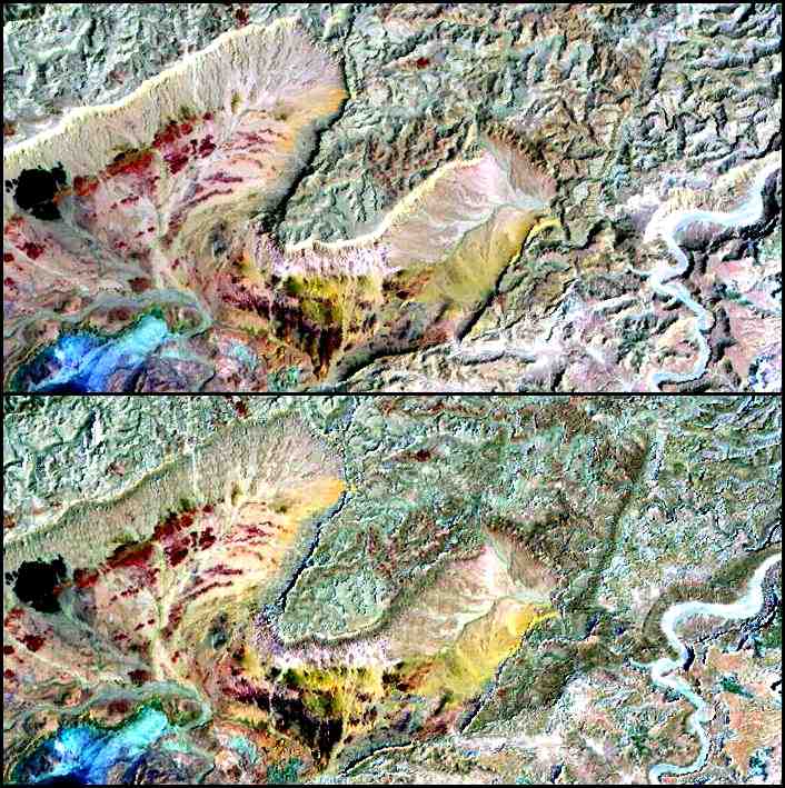
 3. Landsat-5 TM Imagery
The next image is a small Landsat-5 TM sub-scene of Makhtesh-Ramon (Israel) acquired on 21st
September 1995. The solar zenith angle is 44.5 degrees, the solar azimuth angle is 124.8
degrees. The image was processed in the framework of a joint German-Israeli
Foundation project.
The top part presents the original data of TM bands 7/4/1 (coded RGB, respectively). The
bottom part of the figure is the surface reflectance after combined atmospheric/topographic
correction. Most of the topographic features that can be seen in the original
image are eliminated in the surface reflectance image.
 (90k)
(90k) The topographic influence causes an enhancement of apparent surface reflectance values. Thus, surfaces oriented towards the sun appear to have higher reflectance values than the same surface cover oriented away from the sun if the influence of topography is neglected. This effect is compensated for in the corrected image because the topographic information is employed to calculate a reflectance map for a flat terrain.